
Mapping / Geospatial Analysis
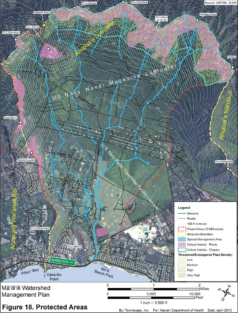
Virtually all of our projects require maps to record data, spatial relationships and physical planning concepts. Some special projects are almost exclusively focused on mapping and geospatial analysis, using Geographic Information System (GIS) software to investigate and document important land data, geographical features and land management concepts.
Services
- Natural Resources / Conservation / Land Use Plans
- Water Resources / Watershed / Ahupuaʻa Planning
- Community and Regional Plans
- Native Hawaiian Projects
- Site Planning / Permits
- Environmental Assessments / Environmental Impact Statements
- Affordable and Workforce Housing
- Community Outreach / Facilitation Services
- Mapping / Geospatial Analysis